


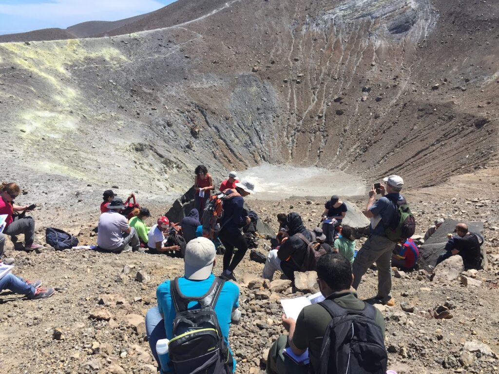
Over the past decade, Ali Asgary, associate professor of disaster and emergency management in York University’s School of Administrative Studies, has been running an annual emergency exercise training and is involved in field research on Vulcano Island in Italy alongside an international team organized and led by the University of Geneva.
Most recently, the team published two articles, “Assessing the effectiveness and the economic impact of evacuation: the case of Vulcano Island Italy,” and “Integrating hazard, exposure, vulnerability and resilience for risk and emergency management in a volcanic context: the ADVISE model,” based on their research focusing on volcanic risk assessment and emergency evacuation simulation, and visualization for the island.
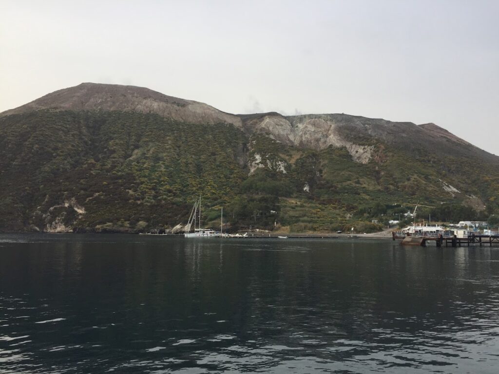
Coincidently, the research is gaining attention and provides useful resources as the island’s volcano is becoming more active during the past month. On Nov. 22, the mayor of Vulcano, Marco Giorgianni, ordered the evacuation of nearly 300 people and banned tourists due to increased volcanic activity and gases near the La Fossa crater.
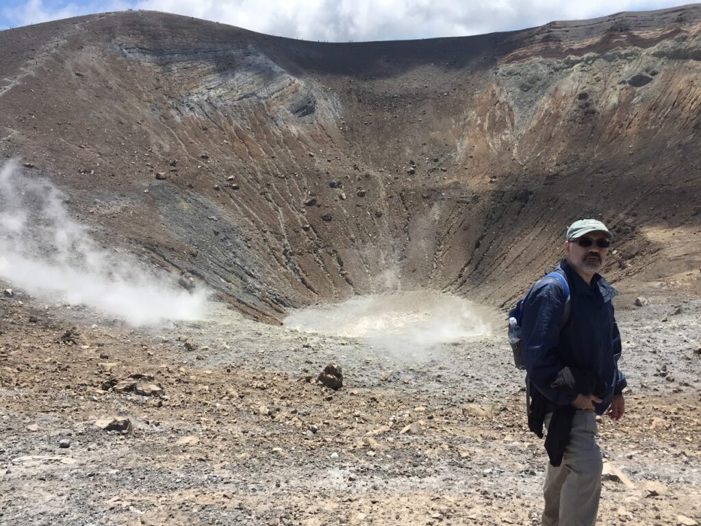
“This island hosts a number of active volcanic systems,” says Asgary, an expert in disaster, emergency and business continuity management and associate professor in the Faculty of Liberal Arts & Professional Studies. He explains the term ‘Vulcanian eruption,’ derived from the island of Vulcano, located in Sicily’s Aeolian archipelago, generally involves moderate explosions of gas laden with volcanic ash.
“We have been running annual emergency exercise training and field investigations on this island for more than a decade and have developed a number of risk assessment models, emergency evacuation simulations and virtual reality applications to help local and national emergency managers, and the public to better prepare for possible future eruptions,” says Asgary.
The studies contain research focused on evacuation planning and management, representing a key aspect of volcanic crises. Evacuation is a very complicated decision process and operation when it comes to volcanos. Effective evacuation allows for the protection of people from hazards while minimizing potential impacts on the economy and livelihood.
One research article explains, the “assessment of evacuation scenarios that consider human and economic impact is best done in a pre-disaster context as it helps authorities develop evacuation plans to make informed decisions outside the highly stressful time period that characterizes crisis.”
The team developed an intergrAteD VolcanIc risk asSEssment (ADVISE), focusing on two temporal dimensions that authorities must address in a volcanic context: short-term emergency management and long-term risk management.
“Our research team has done extensive analysis of hazards and vulnerability and the overall risks of volcanic activities in the island by creating various maps and models that can be used to identify high-risk areas regarding different volcanic hazards such as lava flow, ballistics, tsunami, ash accumulation, lahar, CO2 gassing and more,” says Asgary.
The team’s ADVISE model addresses the potential physical, functional and systemic damage determined by combining the available information on hazard, exposed systems and vulnerability.
“Throughout this period, we have been working very closely with experts from Civil Protection Italy and the INGV (National Institute of Geophysics and Volcanology) in particular. We have also worked with the local school and the community members to raise awareness,” says Asgary.
The last eruption on Vulcano was more than 130 years ago and lasted from Aug. 2, 1888, to Mar. 22, 1890. Volcanic regions that represent tourist attractions and where tourists are allowed to go very close to hazardous areas are especially risky.
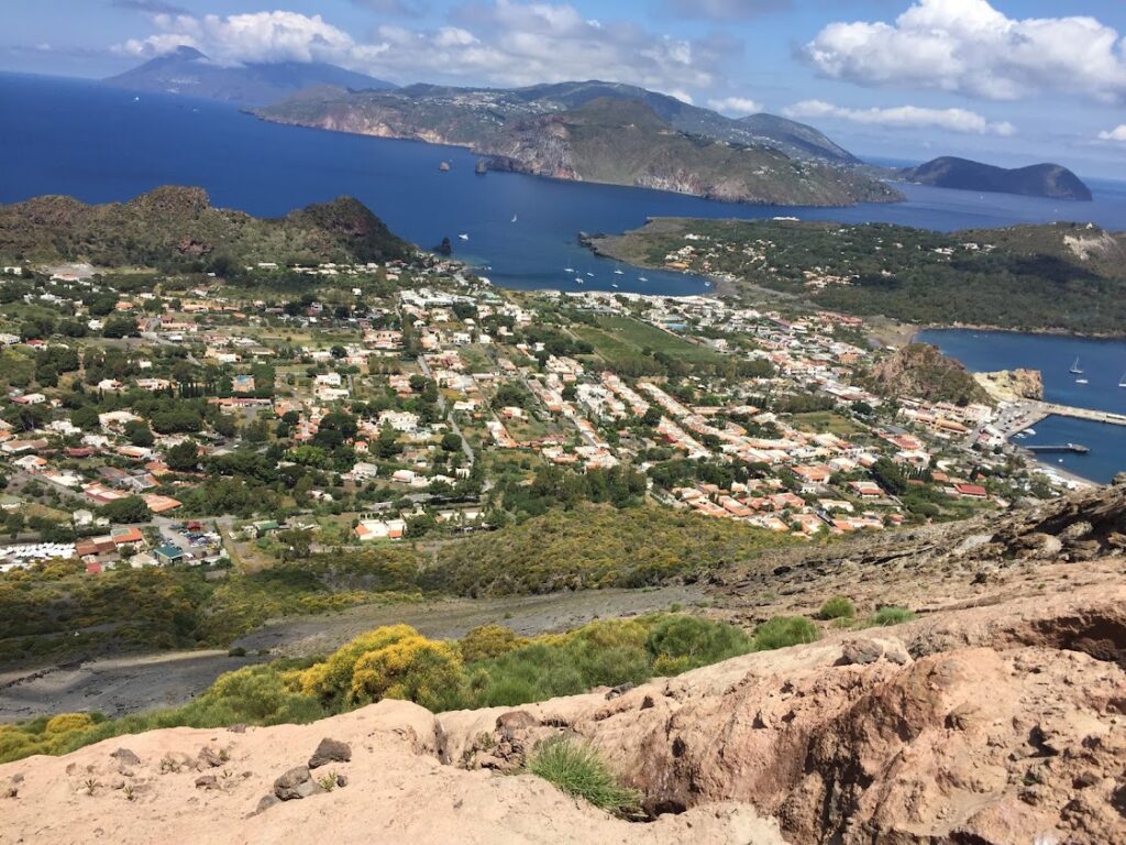
The island of Vulcano is home to nearly 800 permanent residents. During the midst of tourism season (April to October), the island could see up to 28,000 per month.
“It would be interesting to see which scenarios we have been examining during the past 10 years will unfold if an eruption occurs. Considering we are currently in the low season when the total population of the island is already low, and that the volcano’s activity is rising slowly, and by taking initial proactive measures, fortunately, we can minimize human impacts in case of an eruption. However, the impacts on the properties and infrastructure will remain to be seen if an eruption occurs,” says Asgary.
In previous years, Asgary would invite two students from York’s Masters of Disaster & Emergency Management (MDEM) program to join a group of international trainees and supervising professors to participate in a training program, to study the island and conduct field research. Students would learn about various volcanic hazards, vulnerability and risk assessment, emergency management and evacuation planning.
Asgary mentions any future visits and training on the island will depend on the type and length of the possible eruption.
By Alysia Burdi, YFile communications officer